Route Guide: Utah Canyon Country Traverse
~800–950 miles. Five national parks. Scenic Byway 12 at the center of it all.
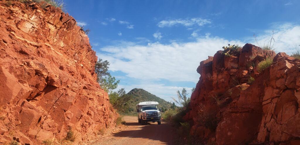
Utah doesn’t ask you to choose between parks. It dares you to connect them. This loop stitches together some of the most concentrated public land scenery in the country into a single, flexible route designed for travelers who don’t need hotels, don’t love rigid plans, and don’t mind adjusting their day based on light, weather, or a campsite that turns out to be better than expected.
The full circuit links Zion National Park, Bryce Canyon National Park, Capitol Reef National Park, Arches National Park, and Canyonlands National Park, with Utah Scenic Byway 12 acting as the geographic and emotional spine. The miles add up quickly once you factor in park roads, scenic drives, and detours that are hard to ignore. That’s not a bug. That’s the design.
This Route Guide belongs alongside the California Parks Loop, Cascade Loop, North Rim of the Grand Canyon, and Beartooth Highway for the same reason: it rewards self-contained travel. Fuel planning matters. Campsites aren’t guaranteed. Weather changes the plan. And the freedom to stop when something feels right is more valuable than sticking to a schedule.
Loop Overview
- Starting Point: Springdale or St. George, Utah
- Total Distance: ~800–950 miles depending on detours and side trips
- Best Seasons: April–May and September–October
- Why it works: High scenic density, short connectors, and terrain that favors nimble rigs over oversized RVs
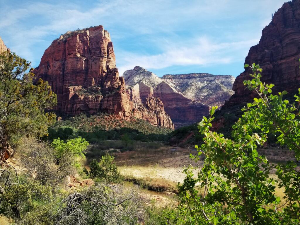
Zion National Park
Vertical scale and managed chaos
Zion is the most visited park in Utah and the most regulated. That’s not an accident. Zion Canyon funnels traffic into a narrow corridor with limited parking, which is why the park operates a mandatory shuttle system for most of the year. The upside is access. Once you’re on the shuttle, you can move easily between trailheads without worrying about parking or traffic.
Zion’s geology is defined by Navajo Sandstone cliffs rising thousands of feet above the Virgin River. Short walks like Riverside Walk deliver big scenery with minimal effort, while longer hikes like Observation Point or Angels Landing require planning, permits, and a realistic assessment of exposure and crowd tolerance. Flash flooding is a real concern in narrow canyons, and the park frequently closes routes when storms threaten upstream.
Camping inside the park is limited and competitive, which makes Springdale and surrounding BLM land practical bases. Zion works best as a focused stop. See the canyon, hike once or twice, then move on before the crowds start dictating your day.
Quick Look
- Drive time to Bryce: ~85 miles
- Highlights: Zion Canyon Scenic Drive, Riverside Walk, Observation Point
- Notes: Shuttle-only access during peak season; flash flood awareness required
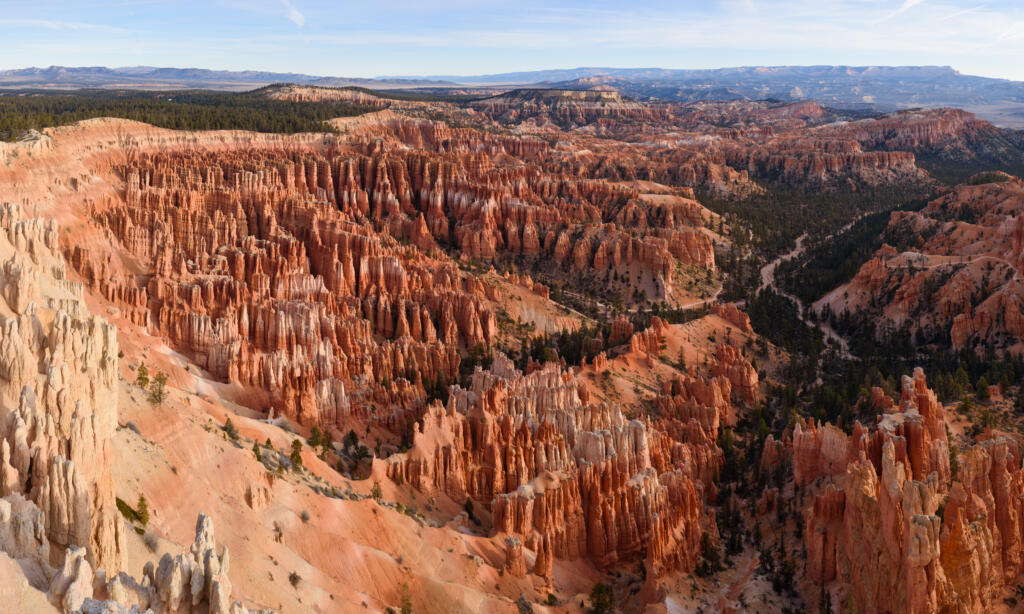
Bryce Canyon National Park
High elevation, compact impact
Bryce Canyon feels manageable until you look over the edge. The park’s famous amphitheaters are carved by freeze-thaw cycles rather than rivers, resulting in dense clusters of hoodoos that glow at sunrise and sunset. At roughly 8,000 to 9,000 feet in elevation, Bryce is noticeably cooler than Zion, especially overnight.
The park’s rim road connects a series of viewpoints that deliver immediate payoff. For those willing to descend, trails like Queen’s Garden and Navajo Loop provide an immersive experience among the formations without committing to a full-day hike. Bryce is also recognized as an International Dark Sky Park, making nighttime photography and stargazing legitimate reasons to stay put.
Camping inside the park is straightforward but limited by site size and availability. Forest Service roads outside the park offer quieter options for self-contained rigs, especially during peak summer months.
Quick Look
- Highlights: Sunrise Point, Inspiration Point, Queen’s Garden
- Activities: Short hikes, photography, night sky viewing
- Notes: Cold nights year-round; snow possible well into spring
Utah Scenic Byway 12
The reason this route exists
Utah Scenic Byway 12 runs between Panguitch and Torrey, but its importance has nothing to do with endpoints. It’s a cross-section of southern Utah’s geology in under 125 miles. Red Canyon’s tunnels ease you in. Kodachrome Basin’s monoliths add texture. Escalante marks the last reliable resupply before things thin out. Then the road climbs onto Boulder Mountain and rides the Hogback, a narrow ridge with steep drop-offs on both sides.
The Hogback section is paved, but exposure and wind make it memorable. This isn’t a place to rush or drive distracted. Beyond Boulder, the road climbs above 9,000 feet through forest and alpine meadows before descending toward Capitol Reef.
Hiking options along UT-12 range from roadside strolls to longer commitments like Lower Calf Creek Falls, a six-mile round trip hike to a perennial waterfall fed by springs. Weather and water availability vary dramatically across this stretch, and cell service is unreliable. Planning matters here.
Quick Look
- Distance: ~120–125 miles (Panguitch to Torrey)
- Highlights: Red Canyon, Kodachrome Basin, Calf Creek, Hogback
- Notes: Wind exposure, elevation swings, limited services
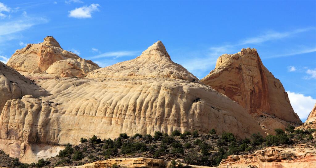
Capitol Reef National Park
Quiet, deliberate, and underrated
Capitol Reef protects the Waterpocket Fold, a 100-mile-long wrinkle in the Earth’s crust that creates cliffs, domes, and narrow canyons. Unlike Zion or Bryce, Capitol Reef rarely feels crowded, even in peak season. The Fruita district, settled by Mormon pioneers, still contains orchards maintained by the National Park Service, and visitors are encouraged to harvest fruit when in season.
The Scenic Drive offers access to Capitol Gorge and Grand Wash, both of which provide canyon walking without technical difficulty. Fruita Campground sits beneath towering cliffs and functions as an excellent base for exploring the park’s central features, though site sizes and maneuverability should be checked in advance.
Capitol Reef excels at low-key exploration. It rewards travelers who slow down, walk short distances, and spend time noticing details rather than chasing marquee sights.
Quick Look
- Highlights: Scenic Drive, Capitol Gorge, Fruita orchards
- Camping: Fruita Campground
- Notes: Limited cell service; narrow campground loops
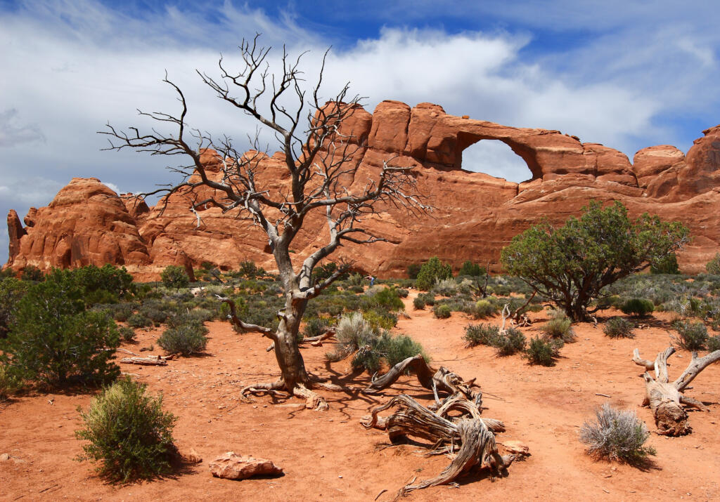
Arches National Park
Icon density with constraints
Arches contains over 2,000 documented natural arches, formed by erosion in Entrada and Navajo sandstone. The park’s road system provides access to most major features, but popularity has led to timed entry requirements during much of the year. These controls help manage congestion but require advance planning.
Delicate Arch remains the park’s most iconic feature and requires a moderate hike with exposure. The Windows Section and Balanced Rock offer high reward for minimal walking. Summer temperatures regularly exceed 100°F, and shade is scarce.
Camping inside the park is limited, making Moab and surrounding BLM land the practical alternatives. Arches works best when approached early or late in the day, with realistic expectations about crowds and heat.
Quick Look
- Highlights: Delicate Arch, Windows Section, Balanced Rock
- Notes: Timed entry required seasonally; extreme summer heat
Canyonlands National Park (Island in the Sky)
Perspective and space
Island in the Sky sits on a mesa above the confluence of the Colorado and Green Rivers, offering expansive views into Canyonlands’ vast backcountry. Unlike the Maze or Needles districts, Island in the Sky is accessible via paved roads, making it the most approachable section of the park.
Mesa Arch at sunrise is well known, but Grand View Point and Green River Overlook deliver equally impressive views with fewer people. Wind exposure is common, and weather can change quickly. Camping options are limited within the park, but nearby BLM land provides alternatives for prepared travelers.
Island in the Sky is a fitting place to slow down and take stock. The views are less about drama and more about scale.
Quick Look
- Highlights: Mesa Arch, Grand View Point, Green River Overlook
- Notes: Wind exposure; limited in-park camping
Wrap-Up and Extensions
This loop works because it doesn’t force completion. It gives structure without rigidity and rewards travelers who value flexibility over efficiency. Utah Scenic Byway 12 anchors the experience, but the surrounding parks give it weight and context.
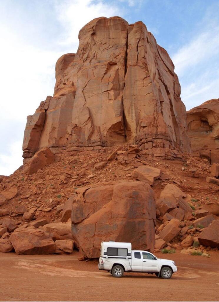
If you have extra time, extensions toward Monument Valley, Grand Staircase–Escalante backroads, or even a southern return via Page add mileage without diluting the experience. Or don’t. The point is having the option.
There’s no finish line here. Just a lot of road, stacked close together, where having your own space makes all the difference.